
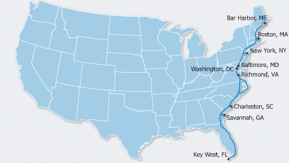
Route Overview-Richmond VA to Boca Raton FLA
 Riding Conditions
This section of the route is full of contrasts. We’ll be passing through forest and swamps, Revolutionary and Civil War battlefields, seacoast and villages. There are numerous wildlife refuges to see and hike through. Yet we’ll also be riding through some highly developed areas in Florida to which throngs of tourists flock and where many people have retired. This route can be ridden year-round, but the northern part can be quite cool in the winter, so we plan on getting to the Florida border no later than the first week of November.. Temperatures should be moderate, though beach riding will be tempered by ocean breezes. Due to changing local conditions, it is difficult to predict any major wind patterns. While there is some hill climbing upon leaving Richmond, Virginia, generally the terrain is either rolling or flat.
Route
Leaving Richmond, we'll head south through the farmlands of Virginia and encounter some swamps when crossing into North Carolina. There are two route options available for us in North Carolina. Weather permitting (after all, it will be hurricane season) we’ll ride the Outer Banks Alternate, giving us the special treat of biking along the sandy beaches of the Atlantic Ocean. The winds can be strong (that's why the Wright Brothers flew their first plane there), and sand may blow onto the road. In the Outer Banks, there are two ferry rides, one of which is 2-1/4 hours long. After the Outer Banks, we'll ride through Camp Lejeune Marine Corps Base, biking by the "Tank Xing" signs. Heading southward, we'll cycle through the busy city of Wilmington, North Carolina, and take another ferry ride into Southport. From there, we'll pass through farmlands and swamps of South Carolina’s “low country”. We plan on taking the 34-mile spur into historic Charleston, SC for a few days of sightseeing and relaxation.
Heading into Georgia, we’ll encounter more farms and swamps. Another spur will take us into charming Savannah, which has one of the largest national historic landmark districts in the United States. The best swamp of all, the Okefenokee National Wildlife Refuge, is four miles off route. It is one of the largest and most primitive swamps remaining in the nation. There we should be able to see numerous alligators of all sizes, stroll on boardwalks over the marshes, and take a boat ride through the swamp. Crossing into Florida, we’ll ride by some timber plantations with signs indicating when the trees were harvested, replanted, and expect to be harvested again.
As we pedal further south, we'll skirt around the northeast corner of Jacksonville, Florida, and begin to see the waterfront homes of retirees. From there it's beach riding along the Atlantic Ocean to St. Augustine, the oldest European settlement in the United States, which displays distinctive Spanish architecture. Starting in St. Augustine, the route alternates between urban and suburban conditions most of the way down the coast to our destination in Boca Raton. Florida has an extensive though sometimes confusing network of bicycling facilities ranging from 2 foot bike lanes or shoulders to separated bike paths and sidewalks. For some stretches it will probably be better for us to use the sidewalk rather than the road. The approach to often nearly invisible short bridges are usually marked with "frogs", "buttons", "turtles", "slugs" or rumble strips.
We plan to take advantage of the opportunities to enjoy the numerous beach accesses. County parks often include such amenities as picnic tables, cold water, showers and toilets and are inexpensive or free to cyclists. State Highway A1A will change names many times on its journey along the coast. This is especially true as it nears Miami. Often it is located adjacent to an aquatic preserve or wildlife refuge offering bird watching as well. South of Jupiter, campgrounds for tenting are almost nonexistent so we will probably be staying at one of the numerous hotels along the route.
Because of the flat terrain, we probably will be upping our daily mileage as we get closer to our destination. Rainbow’s end will be Mom’s house in Boca Raton (near Fort Lauderdale), where we can regale her with stories and share the adventures we had along the trail.
posted by Matt and Mary Ellen | 11:03 PM
![]()
![]()
2 Comments:
I can hardly wait to meet Olga!!
Sherrie
Mom and I are sitting at my desk reviewing your route and game plan.
I am going to print out the blog's contents for Mom so she can read it on the way back to Fla. Once your trip begins, and if Mom can't retrieve your blog updates, I will call her and read your latest narratives.
This is Mom speaking,"and I still think you should write a book!!"
All our love and good wishes,
Dick, Mom and Barbara
Post a Comment
<< Home