Olga and Bob's Most Excellent Adventure

Olga (our trusty tandem bike) and BOB (our trailer) will take us from Maine to Florida along the Adventure Cycling Associations' East Coast Route. The trip begins on August 30th and will end sometime in early November. We'll be blogging along the route so check back often for the latest posting. If you want to read this in chronological order, start from the bottom and work your way up. Otherwise, it may not make sense. See you on the trail!

Name:
Location: Helena, Montana, United States

In the Spanish speaking world south of the US border they have a term for people like us..."jubliados". It implies that the later years of ones life is to explore, discover and expand their horizons. We embrace the concept and hope to share some insights with you.

Tuesday, October 31, 2006

Doin' the Charleston

It was pouring rain (Warm Rain III) but we didn't care. We knew that with any luck, we'd be in Charleston by late afternoon with a roof over our heads and the opportunity for a night on the town. Our route took us directly through the Francis Marion National Forest. We were riding through a corridor of pines, rain splashing down, but with no traffic to speak of, it was rather smooth (albeit wet) sailing.

The Swamp Fox
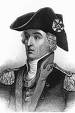
For those that grew up watching "The Wonderful World of Disney" on black and white televisions, they're sure to recall the story of the man known as "The Swamp Fox". Francis Marion was an American revolutionary war hero, nicknamed the "Swamp Fox" by the British because of his elusive tactics. In 1761 he first distinguished himself as a lieutenant of militia by defeating some ambushed Cherokees. In 1775, Marion was elected to the South Carolina Provincial Congress as a representative. This Congress authorized the formation of two regiments, Marion was captain of the Second Regiment. In 1780 as a lieutenant colonel in the Continental service, Marion led an attack on Savannah. In May of 1780 Gen. Benjamin Lincoln surrendered Charleston to the British.In August 1780, Marion commanded guerrilla warfare against the Loyalists along the Peedee and Santee rivers. Marion chased away three Loyalist groups. Turning upon the British, Marion cut their supply lines, outran Sir Banister Tarleton's dragoons, raided Georgetown, retired to Snow's Island, and then again raided Georgetown.After the Continentals returned to South Carolina, Marion served as brigadier general of the militia under Gen. Nathaniel Greene. Aided by Continental troops, Marion finally seized Georgetown.

At the battle of Eutaw Springs on September 8, 1781, he commanded the militias of North and South Carolina and drove the British back to Charleston.Marion was quiet and moody, yet humane and forgiving. He rose from private to brigadier general because of his intuitive grasp of strategy and tactics. Daring and elusive, he usually struck at night and then vanished into the swamps and morasses of the South. Many believe that the character portrayed by Mel Gibson in the movie "The Patriot" is based on Marion and his exploits.

Arriving on the outskirts of Charleston, the wind picked up and the rain became intense. We sought refuge at a local pizza parlor where they owner took pity and offered shelter from the storm, free coffee, as well as a good slice of NY style pizza. A new bridge links Charleston with nearby Mount Pleasant (complete with a wide bicycle/pedestrian walkway), but to get there, we needed to traverse some 10 miles of urban congestion. Maybe if the sun was shining it would have been fine, but the roadways were flooded and we got out the state highway map to devise plan B which took us on a rather circuitous but very safe route to the bridge. As we pedalled up the ramp entry, the sky finally cleared, and we coasted our way into Charleston and our nights lodging at the "Not So Hostel" hostel.

We chose the hostel because it would be inexpensive and located within walking distance to the downtown historic district. In hindsight, it was not one of the better decisions we've made. Located in a "transition" neighborhood, our room was tiny, the bed matress had more lumps than bad mash potatoes, and we had to share a bathroom with three others. That was somewhat to be expected, but as we discovered after the fact, we could have booked a hotel room two blocks away for $65 and spared ourselves the aggravation. So it goes.

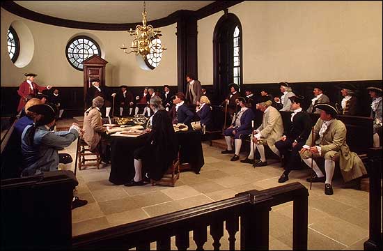
A Bit about Charleston
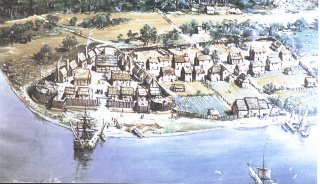
Much has been written about Charles Town, which was named in honor of King Charles II of England. King Charles was known for many things, but was most notorious for his womanizing and his lifestyle as a hedonistic pleasure seeker. His father was beheaded by the puritans for his exploits. It has been said the King Charles was "the father of his people, or at least, a great many of them." Founded in 1670 at Albemarle Point, early settlers were threatened by Spanish more than Indians, and Albemarle Point provided a vantage point from which to view any approaching vessels.

By 1690, Charles Town was America's fifth largest city. Initially, the population consisted mostly of English settlers, and later added many French Protestants called "Huguenots" as well as quite a few Irish.

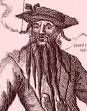
Early Charles Town suffered a serious threat by murderous and thieving pirates, most notably Blackbeard. Blackbeard was apprehended and convicted in 1718 but quickly escaped. He was later captured and killed . Also threatened by Spaniards and Indians, it didn't take long for resentment to build against the English Lord Proprietors who were neither willing nor able to protect Charles Town from her attackers. Revolutionary activity began in Charles Town as early as 1719.

In spite of Charleston being referred to as "The Holy City", most likely because of the church steeples that distinguish the skyline, Charles Town was known more for its tolerance and decadence than religious fervor. In fact, the story line goes that there are 179 churches and over 200 bars in modern day Charleston, which seems like a good ratio to us.

Slavery was not a significant part of the first 30 years of Charleston history as she was mostly a trading town. By 1710, part of the very profitable trade and commerce in Charles Town involved the buying and selling of slaves which contributed significantly to early fortunes both from the trade of slaves and from planting using slaves.

Charles Town became one of the largest and wealthiest cities in America as the result of the trading of indigo, rice and slaves. African Slaves brought their knowledge of rice planting with them as well as the ability to survive the heat and disease. The same genes that made them prone to sickle cell anemia, made them resistant to malaria and yellow fever.

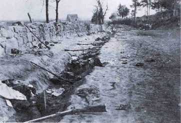
Charleston is known most for its charm and history; it's an experience that's difficult to convey. Charleston has a very unique story which there isn't time to tell here. The preseervation and restoration of the homes in the historic district is truly remarkable considering the history of the city. Charleston was devastated by several forces both natural and man-made, but probably nothing took more out of Charleston than the Civil War. With many buildings burned or severely damaged by the sustained artillery siege on Charleston, due to the economic destination that followed the Civil War, there was no money to tear down and rebuild. So Charleston remained in horrible condition for years, but with the original structures still intact. It is these structures that have been transformed into what is now known as one of America's most liveable and beautiful cities.


Trail Angel Marilyn
Good fortune smiled on us once again, as we had the pleasure of a great guide to the city. Our connection to Marilyn Durkee was through Mary Ellen's sister Donna. Mary Ellen had met Marilyn Durkee a few years ago when she was at a cooking school in France, but we were not prepared for her graciousness and hospitality during our stay. She drove us around the city, helping us take care of important chores, and was a fount of knowledge about the town and what it's like living in Charleston. She dedicated two days of her life to us, introducing us to her friends and city, and we were truly fortunate. Thanks Marilyn. You're an angel.

We were suprised at how vibrant the town seemed. There are three colleges located in Charleston, and the place was hoppin' with young folk. There were numerous restaurants to choose from (we did seafood and our first Carolina style barbeque), art galleries, museums...all the trappings of a live and thriving community. Our stay was short but fun filled. We were told that a cold front was coming in, and knew that we needed to continue our journey south. Leaving town by SR61, we rode passed three different historic plantations lined with some of the most spectacular live oak trees drapped with Spanish moss we had seen to date. Our destination for the evening was Givehans Ferry State Park, and we made it to the campsite with the last rays of sunlight in the western sky. The temperature was dropping, and we busily started to scout the area for firewood. It was going to be a cold, clear night, and a warming fire would be most welcomed.

Friday, October 27, 2006

2000 Light Years from Home

Let the record show that at 1:34 PM, 7 miles North of Chubby Checkers hometown (Andrews SC), on our 43rd day on the trip, the odometer registered 2000 miles! We stopped to hug, kiss, and celebrate with a well deserved banana break. Words cannot express the feelings we shared.

To add to the celebration, we were in the midsts of our record setting day. Between Conway and Charleston, the route passes through some of the most rural areas of the South Carolina lowlands. Swamps, bogs, forests and more swamps, punctuated every so often with a small hamlet or rural store. We found that in these communities, the old fashioned country store is THE place that people go. They're not fancy, and they certainly aren't offering specialty coffee drinks. In fact, we discovered the joys of chili dogs and boiled peanuts. The best chili dog to date was in Pleasant Hill, SC. While we saw no evidence of a hill, they sure did make a mean chili dog, with the request onions, cheese and other trimmings. Boiled peanuts are another treat that shouldn't be missed. Soft, tender...we both prefer the cajun over the original style. It is the lunch choice of champions!

Fueled by the local delicacies, we rode over 72 miles that day. It was sunny, the wind was to our back, and it was effortless. Our trial began when we tried to locate our camp site for the evening. The South Carolina highway map indicated that there was a campground near Jamestown, about 50 miles from Charleston. This was perfect as it meant we could be in the city the next day. What we didn't know was that the campground was 7 miles off route, 3 miles down a dirt road, and that it was the last day of deer hunting season with dogs. Apparently, in SC one can still hunt deer using canines in certain districts. We were not about to do "rough" camping in the middle of hunting season, but it still unnevered us to be riding along a road that had significant hunter traffic. Dog hunting seems a bit strange to us. The "hunter" puts a radio tracking collar on their hound and drives up and down the road holding an antenna out the window, trying to pick up the dogs signal. The animals are trained to herd the deer back toward the road, where they can be easy pickin's for the hunter. So much for fair chase.

We pedaled hard and fast, not wanting to be caught in a cross fire of some over anxious rifle man who had not yet filled his quota. Getting to the campground, we found the last site available, and spent a "unique" evening listening to the hum of propane power generators. These folks had enough juice going to light up a ballpark for a night game, but we weren't about to say anything. We spent a rather restless night, never really getting to sleep. After waiting a few hours after sunrise, we donned our brightess colors and rode the heck out of there towards Charleston. It was starting to rain but we didn't care. After all, it was going to be a "warm rain."

Not Identical Twins

You wouldn't think that there would be that much difference between North and South Carolina, but there you would be mistaken. The change became apparent as soon as we crossed the border. First thing we noticed was more litter along the roadside. We can only pozit as to why that might be, but for some reason, North Carolinians keep their garbage in the cars, and their Southern cousins seemingly toss it out the window. We also noticed that the road surface was rougher, and shoulders or accomodations for bicyclists were virtually non-existant (at least in this part of the state. It would change some as we moved southward). We had also started to observe Palmetto Pines in NC, but they were evident everywhere (including on the license plates) in SC. It gives a nice, almost tropical feel to the place.

A Long, Rich and Unique History

South Carolina stretches from the Atlantic Ocean to the Blue Ridge Mountains, containing 31,113 square miles. Fortieth in geographic area among the fifty states, it ranks twenty-sixth in population.

Spaniards explored the South Carolina coast as early as 1514. Spanish fears of French rivalry were heightened when Huguenots led by Jean Ribaut attempted to settle on what is now Parris Island near Beaufort in 1562. After Ribaut returned to France for reinforcements, the soldiers who were left behind revolted, built themselves a ship, and sailed for France the next year. The horrors of that voyage went beyond eating shoes to cannibalism before an English ship rescued the pitiful remainder of the French attempt to colonize here.

The Spanish built Fort San Felipe on Parris Island in 1566 and made the new settlement there, and made it the capital of La Florida Province. This was a good 50 years before Jamestown was settled. In 1587 after Sir Francis Drake had destroyed St. Augustine, the Spanish decided to concentrate their forces there. With the withdrawal from Santa Elena to St. Augustine in 1587, South Carolina was again left to the Native Americans until the English established the first permanent European settlement at Albemarle Point on the Ashley River in 1670.

King Charles II had given Carolina to eight English noblemen, the Lords Proprietors. The proprietors' first settlers included many Barbadians, and South Carolina came to resemble more closely the plantation economy of the West Indies than did the other mainland colonies. By 1708, a majority of the non-native inhabitants were African slaves. Native Americans, ravaged by diseases against which they had no resistance, last significantly threatened the colony's existence in the Yemassee War of 1715. After the colonists revolted against proprietary rule in 1719, the proprietors' interests were bought out and South Carolina became a royal province.
By the 1750s, rice and indigo had made the planters and merchants of the South Carolina lowcountry the wealthiest men in what would become the United States. Government encouragement of white Protestant settlement in townships in the interior and migration from Pennsylvania, Virginia, and North Carolina were to give the upcountry a different character: smaller farms and a larger percentage of German, Scots-Irish, and Welsh settlers. By 1790, this part of the state temporarily gave the total population a white majority, but the spread of cotton plantations soon again made African American slaves the majority.

Charlestonians were strong supporters of their rights as Englishmen in the Stamp Act crisis in 1765, and South Carolina would play a significant role when differences escalated into the American Revolution. Over two hundred battles and skirmishes occurred in the State, many of them vicious encounters between South Carolinians who opted for independence and those who chose to remain loyal to King George.

The first shots of the Civil War were fired in Charleston Harbor on April 12, 1861. Two days later the federal garrison in Fort Sumter surrendered to Confederate forces. Union troops occupied the sea islands in the Beaufort area in November, beginning the move toward freedom for a few of the state's slaves, but few military engagements occurred within the state's borders until 1865. One-fifth of South Carolina's white males of fighting age were sacrificed to the Confederate cause, and General William Tecumseh Sherman's march through the state at the war's end left a trail of destruction. Poverty would mark the state for generations to come.

Rapid expansion of the textile industry in the 1890s began the state's recovery from a share-cropper economy, but the boll weevil gave the Great Depression a head start here in the 1920s. The state’s poverty and racial practices caused many African Americans to seek opportunities in Northern cities; after 1920, South Carolina no longer had a black majority. The expansion of military bases during World War II and domestic and foreign investment in manufacturing in more recent decades have revitalized the state. The Civil Rights movement of the 1960s ended legal segregation and discrimination and began the incorporation of the state’s African Americans into the political and economic power structure of the state. In most recent times, tourism and retirees have become a driving force in the economy.

Our first day in the Palmetto State was quite a challenge. While the terrain was still flat, the headwind made it feel like we were pedaling uphill all day. It was a 3 gear wind, and there was no let up. Our moods turned foul, and tempers flared a bit. We've spent a lot of time together on this trip. In fact, people often comment that you really need to be in love to travel like this. Well, they're right...we are in love, but every once in a while the road gets the best of us. Today's disagreement was over what type of bread to buy. Imagine that, standing in the Piggly Wiggly bakery section in Conway SC, arguing over the merits of store bought bagels vs. squishy rolls. The disagreement was quickly settled when Matt did a 180 and headed to the wine section, letting Mary Ellen to choose. It seems ridiculous to even mention it now, but it's just another way to say that hard riding days take on a life of their own. The spat ended as quickly as it began, and we enjoyed another fine dinner, camping along the edge of the Big Cypress Swap on the outskirts of town, enjoying the stars under a clear, moonless sky.

Capt'n Sez...

A few minutes after we left the dock, Captain Sandy came down to greet us. Besides being a ferry boat captain with over 23 years of experience, he was also an avid bicyclist. We came to find out that he spotted us boarding the ferry, and as was his custom, wanted to personally welcome us aboard. He invited us up to the bridge, where we traded stories about cycling, and also learned about what it takes to become a ferry captain. He gave us a map of Southport (the town we would be docking at) and told us that it was definitely worth a few hours to nose around and visit. While we had not planned on it, when you're on a boat you need to follow the Captain's orders, so there was no argument coming from us. And, make no mistake, the Captain knew what he was talking about.

Southport has always attracted sailors, the earliest visiting the area in 1524 and 1526 were French and Spanish explorers. The first European vessel constructed in the New World was built on these banks of the lower Cape Fear River. The town still reaches out to ocean going vessels and Intracoastal Waterway cruisers. After the Civil War, businessmen tried to create a major southern port here by combining river transportation and railroads. The name Southport was chosen in 1887 as part of that promotional effort. Though the town never became a major port city, it did gain telegraph service and a coaling dock for steamships. It's a town close enough to Wilmington to reach the conveniences of a big city and college campuses, yet just out of reach of the interstate traffic. It has become home to a number of retiree's as well as people just trying to get away from it all. The "inner" city is replete with huge live oaks and other splendid trees, as well as Victorian homes. New housing developments were going in along the port area, but it still had a wonderful small town feel and charm. In fact, it was similar in many ways to towns we visited in Maine. We could have stayed longer, but needed to push on.

Leaving Southport we rode through more swamps and pine forests. We also passed a number of housing developments. At the time we had no way of knowing that for the next 100 miles or so we would see the same story repeated over and over...swamps or forests that were now the homes to retirees or vacationers. It seems that all of the coastal regions that we have visited are destined to be developed. Such is the way of progress, but we wonder where all the people and money come from, and what is being lost in the process.

Around the town of Shallotte, we came back to agricultural land and actually purchased some fresh sweet corn from a local farm stand. The route took us back across the intracostal towards Sunset Beach. There were numerous roadside seafood stands to choose from, and being that it was getting late in the day, it was time to stop and replenish our supplies. We stopped at Captain Jacks, a ramshackle kind of place on our side of the road. The Captain was a man of few words. When we asked a question, he replied with curt "Yep" or "Nope" responses. But he sure knew his seafood, and we left with a pound of sea scallops that turned out to be a real treat.

Our destination for the evening was Calabash, right on the border with South Carolina. We were 20 or so miles from Myrtle Beach, and could already see the influence of the development going on around it. We saw a number of developments that were identical to what you see in south Florida...lush, beautifully maintained golf courses and gated residential communities. In fact at last count, there are over 100 golf courses in the area...a true mecca for the golf inclined.

We camped at Captain Andy's Charter Boat and Campground on the banks of the Calabash (yes, named after the gourd that grows in abundance here) River. Captain Andy doesn't do charters anymore. At 70, he says he doesn't need the headaches. In fact, the developers would love to purchase his property, but as he says "Hell, the world don't need 'nother frickin golf course...and besides, where would I go? I love it here." Captain, we couldn't agree with you more.

We bid adieu to the Captain on the next morn. It was a clear, brisk day. The shrimp trawlers were returning to the near by docks fully loaded. Before pedalling off, Capt'n Andy gave us some of his hmegrown hot "peeter peppers" (use your imagination) and told us to expect 20 knot winds from the south. As our route took us due south the whole day, we figured that we'd be heading right into it. We're not sure how much a "knot" is, but as far as headwinds go, this one was a doozy. It was going to turn out to be a challenging day.

Wednesday, October 25, 2006

The Bike Gods Smiled Upon Us

Sometimes you’re good, and sometimes you’re lucky. Today we were the luckiest people in the world! It poured all night and into the morning. We dawdled getting ready, putting off the inevitable. We were certain that we were in for a good soaking, and with 50 miles to go to Wilmington, and not knowing what the road conditions might be, we were definitely not eager to get back on the bike. But by 9 AM we could wait no longer and suited up for the wet day ahead. As we were packing all our gear (which, by the way, we’ve become very adept at) the rain sputtered and then came to an abrupt halt. Talk about good fortune smiling on us. It didn’t rain a drop the rest of the day. The roads were awfully wet, and we wore our rain suits so we wouldn't get soaked by passing cars, but we were lucky indeed.

It was a hot and steamy day. In fact, we both noted that for the first time it felt like we were in the tropics. Surf City had that tropical feel and smell. We don’t know if that is because the Gulf Stream comes close to shore or what, but it sure felt different. Within an hour we were sweating to beat the band, and had to strip down to summer cycling attire. The rest of the day was spent spinning through pine forests and marshes along little used roads. We really didn’t encounter any traffic to speak of, which was surprising considering that Wilmington is a city of considerable size.

Historic Wilmington & NC's Cape Fear Coast encompasses the city and the island communities of Carolina Beach , Kure Beach and Wrightsville Beach . Its beautiful, uncrowded beaches and nearby estuarine reserves provide a haven for sunseekers, beachcombers and nature lovers, and the tourism folks will tell you that it is a sportsman's paradise for anglers, mariners and watersports enthusiasts.

Wilmington's picturesque riverfront emerges from the Cape Fear River . Gracing its banks is one of the state’s largest historic districts, numbering approximately 230 blocks. Across the river on Eagles Island rests the majestic Battleship NORTH CAROLINA, a restored World War II memorial. There are also other museums for children, fine art lovers, railroad and history buffs, including North Carolina 's oldest history museum.

The Cape Fear River the longest river entirely within North Carolina (202 miles), and it flows into the Atlantic near Cape Fear, from which it takes its name. During colonial times, the river provided a principal transportation route to the interior of North Carolina. Wilmington was also an important Confederate port, and a number of naval battles were fought in the area.

We found the city to be warm and inviting, even more so since we had the pleasure of being hosted by Steve and Mary Ann Mangiacapire. We had met Steve on the ferry from Ocracoke Island to the mainland, and they took us under their wing, invinting us into their lives and home. We had a wonderful dinner, did laundry (which is no small thing for vagabonds like us) and drove us downtown to walk through the historic district and see Wilmington at night. It was a great respite, and even though our visit was short, we had a chance to learn about the allure of the area. The community is growing by leaps and bounds, and there's lots of new housing developments. We can understand why. It's a city that we definitely intend on visiting again.

Steve and Mary Ann's home is right on route, and the next morning we continued our journey south, crossing over to Caroline Beach to catch the ferry that would take us from Fort Fisher back to the mainland and south. We stopped for a while at the fort which was one of the last Confederate strongholds to fall in January 1865. The Cape Fear river was critical for the Confederacy, and blockade runners are still revered in local lore. It is said that a ship captain who could get through the blockade would receive $4000 in gold coin, which must have been quite an incentive for them to risk life and limb.

Once again we needed to make a mad dash to the ferry, as we had lost track of time visiting the fort and the nearby beach. We were the last ones on the boat, and as it was pulling away the first mate approached us and told us that the Captain would want to speak to us.

What had we gotten ourselves into now?

Monday, October 23, 2006

Coast to Coast

We needed to ride for another day to rejoin the main route and continue our journey south to Florida. This section of North Carolina is known as “Down East”, similar in name to the area we passed in Maine. It's also been discovered by tourists and real estate developers. Maybe it's a chicken and egg thing...we wonder which comes first, or if they appear simultaneously. The tourism folks have thought of catching names for their area, and they all seem to end in “Coast”. Just to name a few, we passed through the "Silver Coast, Emerald Coast, Crystal Coast", etc. It was hard to differentiate one from another as they all looked the same to us. We met sports fishermen everywhere we went and came to find that there are over 30 different species of game fish in being sought after in the area. Not to mention the oysters, shrimps, scallops, crabs and other delicacies...we were having a field day stopping at roadside stands to purchase the freshest “catch” for dinner. Not to mention the oysters, shrimps, scallops, crabs and other delicacies...we were having a field day stopping at roadside stands to purchase the freshest “catch” for dinner.

The real estate developers have been extremely busy, and there is a transformation underway. You can ride for 20 miles or so through forests only to come upon clearings where the new cash crop is retirement homes. In those areas, the traffic understandably becomes heavier, and shopping malls add to the congestion.

Yet, it is still relatively level terrain and relatively effortless pedaling as the route takes you through pine forests, marshlands, swamps, the intracoastal, etc.. We were making good time as 50+ miles a day became the norm. We had little trouble finding campsites, and even spent a night in a nice facility in the Croatan National Forest. This is timber country, which seems a bit incongruous to Rocky Mountain dwellers who normally associate national forests with the mountains. But the pines grow straight and tall here, and the growing conditions are ideal. Lumber and paper manufacturing are big business in the South East, and we knew we would be seeing more of it as we headed into South Carolina and Georgia.

We were still 2 days from Wilmington when we awoke to a light drizzle and the prospect of a soggy day. The route takes you directly through Camp LeJeune Marine Corps Base before turning towards North Top Sail Island, a barrier island along the coast. It didn't take long before the heavens opened up, and by the time we got to the MP gate at the Base, it was raining pretty hard and steady.

The MP asked us the standard questions that we've come to expect when we meet people...”where you going, when did you start, how long will it take, et. al.” He then wanted to know what it was like to ride a bike in the rain. This one had us stumped. We never were really asked that before, especially straddling the bike in a downpour at a guard station to a military base. After a long, pregnant pause Mary Ellen replied “Well, it's a warm rain so it's not too bad”. Maybe it felt warm because we were pretty steamy inside our rain suits. We were comparatively dry, all things considered, but still felt like clams in wet suits.

We were informed that there were live firing exercises underway and we would need to take the “short” detour around Highway 172 through the base. Short is relative...in a car it was short, for us it was another 45 minutes of head down pedaling. So it goes. We could hear the sound of mortars and howitzers being fired in the distance, and were glad to be on the safe alternative. We came upon a training area that had buildings which appeared similar to those we've seen on TV in Iraq. The sign said it was an “Urban Tactical Training Area”. It is beyond the scope of this blog to expound upon the war and the world situation, but we both were deeply moved by what we observed. We are a nation at war and witnessing the training exercises of those being sent into harms way. This was serious business and gave us pause. Reflecting on what we were observing, we wished all the Marines Godspeed as they perform their service. It was a somber day, and the incessant rain only added to the mood.

It seemed like forever before we exited the base, crossing the bridge over the New River. It had been over 10 days since we had used our small chainring, and it became a matter of personal pride that we not have to gear down. We made it up and over in the middle ring with a gear to spare and enjoyed the "freebie" ride down the otherside of the causeway.

After stopping for a well earned soft served Dairy Queen, we headed back out into the storm for the final 15 miles to Surf City. Crossing the Intracostal Waterway for the umpteenth time onto North Top Sail island when the rain finally ceased. Instead we were greeted by a strong headwind for the final 8 mile push to Surf City. There would be no camping tonight. Even though it was a "warm rain", we were cold, tired, and needed a roof over our head.

At first glance, North Top Sail seemed like all the other beach resort towns we had seen...new expensive homes on stilts interspaced with some older, delapidated trailers or vacant lots. But it quickly became apparent that all was not well on the island. Virtually every property we passed had a "For Sale" sign on it. The island should have been named For Sale, not Top Sail. The real estate "boom" had busted here, and we found that there was a tremendous glut of housing on the market. Which was too bad, because we actually found the island as one of the less commercial and more interesting ones that we had seen to date. But we couldn't concern ourselves with the state of the Top Sail economy just yet. We yearned for a dry room and a hearty meal.

There were plenty of motel rooms available, and we ended up staying at the Islander Inn, complete with a picnic table, microwave and fridge. Bingo! We quickly unloaded and headed to the local seafood shack where we purchased 1/2 peck (that's two dozen for you land lubbers) of oysters and a pound of shrimp. We spent the better part of the night dining on our "catch" and enjoying a suprisingly crisp North Carolina chardonay. It was a splurge night but we had earned it. The rains and winds returned, continuing to pour down on the roof. We didn't know if the rain was ever going to stop, but it didn't matter. We were warm and snug and as we drifted off to sleep, reflected on another incredible day, full of wonder and discovery.


Friday, October 20, 2006

Pirate Lore Galore

The 12 miles from the ferry to the National Park campground was an epic ride. The only access on or off the island is by ferry, so once we got off the boat, we had the road virtually to ourselves the whole way. The sun was warm,with the Atlantic surf pounding on our left (east) and the birds of the salt marshes chirping and singing to our right. We were pedaling along a ribbon of highway without a care in the world. It had been our intention to use the National Park facilities throughout our Outer Banks tour, but were disappointed to learn that all but one site had closed for the season on Columbus Day. Ocracoke was still open, and believe us, it was well worth the effort to get there. We pitched our tent along the dunes, with the Atlantic Ocean breaking just a 100 yards or so away. The night was moonless and the Milky Way put on a spectacular display. The winds of Hatteras had kicked into gear, and it was bit of a challenge to cook dinner. We fashioned a makeshift windbreak with available materials, but can tell you that our campstoves really are not designed to operate at peak efficency in 20~30 mph gusts. It was also one of the coldest nights we had experienced on the trip. Our sleeping bags have been fantastic, but were truly put to the test that evening. They are rated as being comfortable down to 40F, which is true when you have virtually all your clothes on along with wearing a beanie cap. But we came through with flying colors and awoke the next morning to take a leisurely 4 mile spin into the only town on the island, enjoy a cream cheese danish and cup of stout coffee before catching the ferry that would take us back to the mainland.

Ocracoke is a small harbor village, reminding us of places we have visited in the San Juan and Gulf Islands of Washington and British Columbia. It has retained much of it's early charm and character, serving as a home for fishermen. It is now a quiet tourist town, where people walk or ride the flat streets on ballon tire bikes. But it has a notorious history as a hiding place for pirates. Blackbeard often escaped his pursuers by fleeing to shallow waters near Ocracoke Inlet.

During The Golden Age of Piracy (1689-1718), numerous rogues pursued their lawless and murderous trade throughout the New World. Restrictive laws passed by the British Parliament had made smuggling acceptable and even desirable in North Carolina and the other American colonies. Preying upon lightly armed merchant ships, the pirates seized their contents and sometimes killed those who resisted. Because of its shallow sounds and inlets, North Carolina's Outer Banks became a haven for many of these outlaws in the seventeenth and eighteenth centuries. Blackbeard was the most notorious pirate in the history of seafaring. With a beard that almost covered his face, he would strike terror into the hearts of his victims, according to some early accounts, by weaving wicks laced with gunpowder into his hair, and lighting them during battle. A big man, he added to his menacing appearance by wearing a crimson coat, two swords at his waist, and bandoleers stuffed with numerous pistols and knives across his chest. The sight of Blackbeard was enough to make most of his victims surrender without a fight.

If they gave up peacefully, he would usually take their valuables, navigational instruments, weapons, and rum before allowing them to sail away. If they resisted, he would often maroon the crews and burn their ship. Blackbeard worked hard at establishing his devilish image, but there is no archival evidence to indicate that he ever killed anyone who was not trying to kill him. Blackbeard's lawless career lasted only a few years, but his fearsome reputation has long outlived him. Blackbeard was killed in a bloody battle at Ocracoke Inlet on November 22, 1718. During the action, Blackbeard received a reported five musketball wounds and more than 20 sword lacerations before dying. Blackbeard had captured over 40 ships during his piratical career, and his death virtually represented the end of an era in the history of piracy in the New World.

We met no pirates that day. Instead, on the ferry ride to the mainland, we encountered 3 cyclists from the Cape Fear Bicycle Club who were out for a "leisurely 100 mile training ride" who proved to be a wealth of information about the trail ahead. Before alighting, Steve (one of the cyclists) invited us to stay with him in the Wilmington area...another random act of kindness that has come our way. It was a most gracious offer, and one we simply couldn't pass up. We bid "adieu", promising to call once we knew our schedule more precisely, and proceeded on into the "Down East" Country of the North Carolina mainland.

When we started out onto the Outer Banks, we were wondering if we had made the right choice. It took the better part of two days to get there, and the traffic was more than we have come accustomed to in rural areas. During tourist season, it would have been a nightmare. But the night in Ocracoke and the ride through the National Seashore area was definitely worth all the effort, providing memories that will surely last a lifetime.

Thursday, October 19, 2006

Dunes, Lighthouses and Shipwrecks

How are sand dunes formed? Geologists belive that strong water currents from hurricanes and storms wash sand from large offshore shoals onto the beach. Over many years, the wind picks up this sand and blows it inland. These tiny grains of sand evolved into a systome of dunes which now strentches for many miles along the coastline. The dunes are constantly moving, in essence rolling over on themselves. While a number of dunes along the Carolina coast have been "stabilized" with vegetation (to prevent erosion) or housing developments, there still are examples of dunes in their natural state.

Jockey's Ridge State Park is a 414 acre park and is home to the largest sand dune on the East Coast, about 140 feet high. The trek to the top of the highest dune allows a spectacular view of both Nags Head and Kill Devil Hills, as well as the Roanoke Sound and the Atlantic Ocean on opposite sides of the narrow stretch of land. It is an example of a medano- a huge hill of shifting sand that lacks vegetation. There are serveral prominent sand dunes in the area, but Jockey's Ridge attracts visitors of all types-kite flyers, hang gliders, sand surfers, and nature lovers. We spent a good 2 hours walking the dunes and learning about the unique microclimate and the plants and animals that prosper in this harsh environment.

It was 2:30 PM before we took our leave of the Park and realizing that we had about 30 miles to go before sunset, we needed to pedal hard down the rode. Within a few miles we left the housing developments behind and finally found the Outer Banks experience we had anticipated...grand vistas of ocean and sound unspoiled by development. Blessed with a tail wind, we rode strong and hard, covering 34 miles in less than 3 hours. It was bicycling at it's best.

About Cape Hatteras
Cape Hatteras National Seashore is at the ocean's edge, but no well-defined boundary marks where the sea ends and the land begins. It stretches north to south across three islands - Bodie, Hatteras, and Ocracoke. The islands are linked by State Highway 12 - a narrow, paved road - and Hatteras Inlet ferry. Some of the special natural and historical features that you can visit along the way are described briefly below. The highway also passes through eight villages that reflect the nearly 300-year-old history and culture of the Outer Banks. Here land and sea work together in an uneasy alliance. They share many valuable resources. But the sea fuels the barrier islands and there are few places that escape its influence. Dwarfed, odd-shaped trees often caught our eye. Severely pruned by salt-laden winds, these trees are just one example of how the sea affects living things. Closer to the sea, shore birds patrolling the beach for food are interesting to watch. Some catch small fish or crabs carried by waves, while others probe the sand or search under shells for clams, worms, and insects. There are also maritime forests where you leave the sea behind briefly. These woodlands of oak, cedar, and yaupon holly grow on the island's higher, broader, somewhat protected parts. In the protected waters west of the islands you can find excellent opportunities for crabbing and clamming. The ocean also harbors a bounty of life, which includes channel bass, pompano, sea trout, bluefish, and other sport fish. Wintering snow geese, Canada geese, ducks, and many other kinds of birds populate the islands. The best time for observing birdlife are during fall and spring migrations and in the winter. Salt marshes are a source of food for birds and other animals year-round. Here sound waters meet the marsh twice each day as tides come and go, exchanging and replenishing nutrients. At the ocean's edge, you are always on the threshold of a new experience.

The Graveyard of the Atlantic
Bright red holly berries and wildflowers offer a brush of color that enlivens the mostly green, brown, and blue landscape. It is a landscape that is unusually peaceful - but not always. Storms sometimes batter the islands with fierce winds and waves.

To many people, the Outer Banks are synonymous with shipwrecks. Indeed, one would have trouble finding a more representative or fascinating aspect of local history. Just as the sea has always been an integral part of life on these barrier islands, so too have been its many victims. A countless number of ill-fated vessels as well as many of the courageous seafarers who manned them have succumbed to the local "perils of the sea."

Why have so many ships been lost, after the lethal dangers of the "Graveyard of the Atlantic" became widely known? Unfortunately, avoiding these navigational hazards is much more difficult than recognizing them. In days gone by, it was the wooden sailing ship carrying goods and passengers that kept the nation's commerce afloat. To follow coastal trade routes, thousands of these vessels had to round not only North Carolina's barrier islands, which lie 30 miles off the mainland, but also the infamous Diamond Shoals, a treacherous, always-shifting series of shallow, underwater sandbars extending eight miles out from Cape Hatteras. While many believe that navigating Diamond Shoals is the only challenge, there are several other complicating factors.

First, there are two strong ocean currents that collide near Cape Hatteras. Flowing like massive rivers in the sea, the cold-water Labrador Current from the north and the warm Gulf Stream from the south, converge just offshore from the cape. To take advantage of these currents, vessels must draw close to the Outer Banks.

Ordinarily following this course would not lead to trouble, but the storms common to the region can make it a dangerous practice. Devastating hurricanes and dreaded nor'easters overwhelm ships with raging winds and heavy seas or drive them ashore to be battered apart by the pounding surf. Since the flat islands provide no natural landmarks, ships caught in storms often ran aground before spotting land and realizing their predicament.

Combined, these natural elements form a navigational nightmare that is feared as much as any in the world. Pirates, the American Civil War, and German U-boat assaults have added to the heavy toll nature has exacted. The grim total of vessels lost near Cape Hatteras is estimated at over 1000.

While hundreds of these "dead" ships now reside in the Graveyard of the Atlantic, their legacy lives on in many ways. Mariners stranded on the islands often chose to remain, establishing families and a heritage, which continues to this day. Many island residents made a substantial part of their living salvaging cargoes (a practice known as "wrecking") and dozens of local buildings were built entirely or in part from shipwreck timbers. Due to the frequent storms and many other navigational hazards resulting in great loss of vessels, the U.S. Lighthouse Service, U.S. Lifesaving Service (1874-1915), and U.S. Coast Guard (since 1915) have kept a steady watch for almost 200 years.

Cape Hatteras Lighthouse is definitely the most famous lighthouse in the area. Authorized by Congress in 1794, it was first lit in 1803. At that time it was 90 ft. tall, made of sandstone, with a lamp powered by whale oil. The current lighthouse was designed in the 1870's and measures 210 feet tall. The height was needed to extend the roange of the light, which can be seen 12 miles out. The area around the lighthouse was constantly eroding, and after much study and debate, it was determined to move the structure in 1999. It took 23 days to moveit 2,900 feet where it now presently stands. During the summer months visitors can climb to the top to see the view. We weren't able to take advantage of that, but enjoyed it still the same.

The winds had picked up and we needed to set out towards the town of Hatteras to catch the ferry to Ocracoke Island. The headwind was strong and we pedalled hard, but it never seemed like we were making any ground. To get to our chosen campsite before sundown, we needed to catch the 3:30 ferry. It was a race against the clock, one of the few times we felt rushed on our trip. We made it with a scant 3 minutes to spare, and had a chance to catch our breath a relaxing passage across the Sound to Cedar Island and new adventures.


Bicycles Do Fly

No trip to the Outer Banks is complete without a visit to the Wright Brothers National Memorial.

Wind, sand, and a dream of flight brought Wilbur and Orville Wright to Kitty Hawk, North Carolina, where after four years of experimentation, they achieved the first successful airplane flights in 1903. With courage and perseverance these self-taught engineers relied on teamwork and application of the scientific process

They had seemingly settled into respectability as proprietors of a small business. But the Wright brothers of Dayton, Ohio nurtured a barely respectable dream; the possibility of flight. Wilbur, four years older than Orville, was quiet and intense -- a dreamer who could lose himself in books. Orville was outgoing, talkative, and an immaculate dresser. Both combined intuitive mechanical ability with analytical intelligence.
In 1892 they opened a bicycle shop and prospered, but they were restless, especially Wilbur. Their energies were focused by two events of 1896; the death in a flying accident of Otto Lilienthal, the celebrated experimenter with gliders, and the successful launching of powered models by Samuel Langley. The Wright's serious work in aeronautics began in 1899 when Wilbur wrote the Smithsonian for literature. Dismayed that so many great minds had made so little progress, the brothers were also exhilarated by the realization that they had as much chance as anyone of succeeding. Wilbur took the lead in the early stages of their work, but Orville was soon drawn in as an equal collaborator. They quickly developed their own theories, and for the next four years devoted themselves to the goal of human flight.

Many of the components used on their "flying machine" were fashioned from parts they had lying around in their bike shop; chains (to control the rudders and wings), spokes wires (for the wings), gears, hubs, and bike frames (used as braces between the two wings). Unable to find a suitable lightweight commercial engine, the brothers designed their own in their shop.

The brothers were dressed in coats and ties the morning of December 17, 1903-a touch of private ceremony for an event that would alter the world. The pools around their camp were icing up, and the break in the weather might be their last chance of the season. Words were impossible over the engine's roar, so they shook hands and Orville positioned himself on the flyer. The 27-mph wind was harder than they would have liked, since their predicted cruising speed was only 30-35 mph. The headwind would slow their groundspeed to a crawl, but they proceeded anyway. With a sheet they signaled the volunteers from the nearby lifesaving station that they were about to try again.

The stick that moved the horizontal elevator controlled climb and descent. The cradle that he swung with his hips warped the wings and swung the vertical tails, which in combination turned the machine. A lever controlled the gas flow and airspeed recorder. The controls were simple and few, but Orville knew it would take all his finesse to handle the new and heavier aircraft.

"They have done it!" Damned if they ain't flew!"
At 10:35 he released the restraining wire. The flyer moved down the rail as Wilbur steadied the wings. Just as Orville left the ground, John Daniels from the lifesaving station snapped the shutter on a preset camera, capturing the historic image of the airborne aircraft with Wilbur running alongside. Again, the flyer was unruly, pitching up and down as Orville overcompensated with the controls. But he kept it aloft until it hit the sand about 120 feet from the rail. The flight had lasted only 12 seconds, and the distance of the flight was less than the length of an airliner. For the first time, a manned, heavier-than-air machine left the ground by its own power, moved forward under control without losing speed, and landed on a point as high as that from which it started. The brothers took turns flying three more times that day, getting a feel for the controls and increasing their distance with each flight. Wilbur's second flight - the fourth and last of the day - was impressive 852 feet in 59 seconds.

This was the real thing, transcending the powered hops and glides others had achieved. The Wright machine had flown. But it would not fly again; after the last flight it was caught by a gust of wind, rolled over, and damaged beyond easy repair. With their flying season over, the Wrights sent their father a matter-of-fact telegram reporting the modest numbers behind their epochal achievement.

Taking our leave of the Memorial, we wheeled our way south on Route 12. The Kitty Hawk area is quite congested, filled with beach homes, shopping, and all the trappings you associate with modern coastal living. The houses sit on stilts, testimony to the power of the hurricanes that periodically come ashore in these parts. After all, we were on a "barrier" island, so wind, rain, flooding, etc. is par for the course. It is amzaing to see so many high priced homes abutting each other. We could only imagine what a zoo the place must be during the height of the tourist season. Fortunately, the traffic along route 12 is slow moving, and there is a good bike lane to boot. Again the riding was very easy. Most of the bicycles we saw in the area (and there were quite a few) were single speed beach cruisers; wide tires, upright handlebars, the kind of bike that used to be called a "Newsboy" bike because that's what the kid who delivered the morning paper would ride. We were blessed with a great tail wind, and put in a good pace as we headed south to Hatteras Island and the National Seashore.

Tuesday, October 17, 2006

On to the Outer Banks

The ACA route gives riders two options through North Carolina; the inland route which stays on the mainland, generally meandering south through a number of small communities that sit along coastal sounds or waterways, or the Outer Banks option. We opted to ride the Outer Banks in order to visit the Cape Hatteras National Seashore, with the idylic notion that we would have carefree pedalling through the sand dunes, with the ocean breaking on one side, and wildlife abounding in the marshes and bays of the inland side. We actually did find that kind of riding, but it took us two solid days to get there. We needed to ride about 50 miles due East to get close to the barrier islands, and it was early that morning when we crossed the Intracoastal Waterway for the first time.


The Intracoastal Waterway is a 3,000-mile recreational and commercial waterway along the Atlantic and Gulf coasts. Some lengths are natural, others manmade. The waterway runs from its northern terminus in New Jersey, where it connects with the Atlantic Ocean at the Manasquan Inlet, to Brownsville Texas. It is also toll-free, but commercial users pay a fuel tax that is used to maintain and improve it. The creation of the Intracoastal Waterway was authorized by Congress in 1919. It actually consists of two non-contiguous segments: the Gulf Coast Intracoastal and the Atlantic Intracoastal Waterway. The two segments were originally intended to be connected via the Cross Florida Barge Canal, but this was never completed due to environmental concerns. The Intracoastal has a good deal of commercial activity, but it is also used extensively by recreational boaters. On the east coast, some of the traffic in fall and spring is by snowbirds who regularly move south in winter and north in summer. The waterway is also used when the ocean is too rough to travel on.

Our route to Florida will take us back and forth across the Intracostal a number of times, over all types of bridges. This was the first of numerous crossings. As we continued on we came across the first active roadside farmstand since Maryland. Most of the harvest was in, but it is sweet potato season, and we purchased them as well as some collards. We hoped that we would be able to buy some seafood when we got to the coast, as we had been told that the shrimping season was now in full swing.

The terrain to the Outer Banks (locally known as OBX) was flat and non-descript. It dawned on us that we had not used the small chainring on our bike for over 2 days. In fact, the riding here was like being on an exercise bike. While Olga is equipped with 27 gears, we only needed 3 or 4 of them, and that was because of the ever present and shifting wind. There's an old saying among cyclists that no matter which way your going, it's into a headwind. It sure felt that way to us.

To get to Kitty Hawk and Cape Hatteras, you need to ride along US 158 which is a high traffic 4 lane that has a marginal shoulder. The North Carolina DOT has done a good job in placing "Share the Road with Bicycle" signs, but it is little comfort when you're riding a narrow shoulder with cars/trucks speeding by at 50 MPH. Sometimes you just need to put the "pedal to the metal" and ride through it, and this was one of those days. Our image of a quiet coastal ride was shattered (for now) as all we saw were billboards, tacky gift shops, and the ever present (in tourist areas) antique malls. We simply wanted to get the day over with, and after traversing the 3 1/2 mile long bridge over Currituck Sound, we rode past the Wright Brothers Monument (which had closed for the day) and limped into our campground. It had been a somewhat grueling day, our first 60 miler to be precise, but the worst of it was over. That evening we enjoyed a lovely sunset, a few cold beer sand freshly caught shrimp , and looked forward to a good nights sleep.

Everyday is an adventure...and some are better than others. But when all is said and done, we wouldn't trade it for anything in the world. And besides, tomorrow we see the ocean again. The last time we caught a glimpse of the Atlantic was crossing the border between Maine and New Hampshire. The route had taken us west, southwest, and now some 1000 miles later turned back east to the coast. And we would find that we would be amply reward for our efforts as we proceeded on.

Monday, October 16, 2006

The Great Dismal Swamp

Once again we were greeted to a warm and beautiful morning. Humidity hung in the air, and our tent fly was soaked, but the interior was still nice and dry. Our clothes have begun to take on the odor of the surrounding swamp lands, and we resolved to do laundry on a more regular basis. Most of the commercial campgrounds have coin washer/dryer set ups, so this shouldn't be too much of a problem. As an interesting note, the price for an overnight campsite has dropped considerably. We were generally shelling out over $30 a night in the mid Atlantic states, but now the average is around $20 (with better facilities), and even less. It does seem a bit excessive to us that a number of campgrounds charge the same for a tent site as they do for an RV, but you take what the road dishes out.

We continued on South, wheeling through the picturesque lowlands of Southern Virginia. Sometime near midday we crossed the state line into the Tar Heel State, North Carolina.

The Carolinas began as a land grant from King Charles I of England to eight lords in 1629. It was later split into two colonies, North and South. Tobacco has been the chief crop through the state's history, and it still ranks as one of the largest producers of broadleaf tobacco in the world. Peanuts, soybeans and cotton are also important crops, and are grown extensively in the lowlands through which we were riding. Interestingly, there are now over 60 vineyards in the state, producing a number of varieties of wine; indigenous sweet grapes in the coastal regions, and European varieties in the more mountainous region. North Carolina received the moniker of "The Tar Heel State" because for more than a century it was the world's largest producer of tar.

We were struck by two things upon crossing the border. First, the roadside litter had virtual disappered. This was in stark contrast to what we saw in Virginia. Number two is that we noticed a large number of Baptist churches...virtually on every main intersections. We've ridden by numerous churches since our journey began, and have noticed how certain sects dominate a particular region. While we saw a number of churches in the Pennsylvania Dutch country, right now rural NC is the winner, hands down. These folks take their religion seriously.

This section of the route brought us smack dab into the Great Dismal Swap. Scientists believe the Great Dismal Swamp was created when the Continental shelf made its last big shift.

People are not sure who discovered the Great Dismal Swamp but there is archeological evidence which indicates human occupation began nearly 13,000 years ago.

By 1650, few American Indians remained in the area, and European settlers showed little interest in the swamp. George Washington, (yes, that George) visited the swamp and then formed the Dismal Swamp Land Company in 1763, which proceeded to drain and log off part of the area. A five-mile ditch on the west side of the current refuge there still bears his name. In 1805, the Dismal Swamp Cana began serving as a commercial highway for timber coming out of the swamp.

Before and during the Civil War, the Great Dismal Swamp was a hideout for runaway slavesfrom the surrounding area. Some people believe there were at least a thousand slaves living in the swamp. This was the subject of Dred: A Tale of the Great Dismal Swamp, Harriet Beecher Stowe's follow-on to Uncle Tom's Cabin.
While all efforts to drain the swamp ultimately failed, logging of the swamp proved to be a successful commercial activity. Regular logging operations continued as late as 1976. The entire swamp has been logged at least once, and many areas have been burned by periodic wildfires. The Great Dismal Swamp has been drastically altered by man over the past two centuries. Agricultural, commercial, and residential development destroyed much of the swamp, so that the remaining portion within and around the refuge represents less than half of the original size of the swamp.

We camped that night at a state park near the Swamp and had our first serious encounter with mosquitoes. As Lewis and Clark would say in their journals "the moskito's were most trublesome". We hid out in the tent for most the afternoon and into the early evening. We finally ventured out after the sun went down, covered ourselves with DEET, and built a large, smoldering fire to create smoke to drive them away. Our efforts at chemical and biological warfare paid off, and we spent a wonderful evening sitting around the fire, gazing at the stars and Milky Way above.

Trail Angels Abound

Since we had detoured off of the ACA maps to visit Williamsburg, we improvised our own route and found ourselves on County Road 617 on a warm and golden morning, wheeling through the multiple peanut fields and pine forests. We found that the riding in Southern Virginia to be nearly the antithesis of what we encountered in the DC metro area...two lane country roads with virtually no traffic to speak of, and when we did encounter folks, they waved or politely tooted their horns. As we rode along, we observed that a number of fields were still flooded. Even though the rains had subsided two days ago, the creeks were swollen, and evidence of flooding was everywhere. In fact, a number of the bridges we road across had just recently been reopened. Debris, logs, and muck were everywhere, but the yellow police barrier tape was down and it appeared that we had clear sailing ahead.

We stopped to photograph a fully loaded peanut truck, which for us was quite a novel sight. A gentleman stopped to ask us what we were doing, as it probably isn't everyday that two people on a tandem bike are parked along side the road gazing at a truckload of peanuts. We never got the fellows name, but he was a "peanut buyer", purchasing peanuts for one of the three large companies that control peanuts in this part of the world. We knew that peanuts grew beneath the ground, but had no idea how they were harvested or processed. He explained that during harvest season, machines dig up the whole plant and basically turn them over upside down, exposing them to the sun. They are left to dry in the fields for 5-7 days, at which time another piece of machinary "vaccums" them up, separates the peanuts from the plant, and thats what we were seeing in the peanut trucks. An acre yields about 4000 pounds of peanuts, and the farmer gets around 22 cents a pound for their effort. When you consider that a pound of roasted "ballpark" nuts sells for about $3.00 in the store, somebody other than the farmer is making the money off of them. In fact, since subsidies have been lowered, a number of the growers have switched to cotton as a new cash crop.

Sadly, the rain had wreaked havoc on the cotton in this part of the county. The fields looked like soggy tissue paper, with the cotton no longer in puffy balls, but dangling limply from the plants. This had been a costly storm.

We got back on the trail at White Marsh Road. We knew that we were in a wetter part of the world, with names for roads like "White Marsh", or "Middle Swamp". No mention of hills here. Our route took us southward through Isle of Wight county and on towards the Great Dismal Swamp (more about that in the next entry). We were celebrating our good fortune for having weathered the storm in relatively good style, but soon had a startling and totally unexpected obstacle placed right in our way. We crested a small hill only to find that the road was gone...washed out, completely underwater for at least 500 yards. There was no way getting through this one. Homes were flooded, and people were using flat bottomed bass boats to save what belongings the;y could from their homes. There were a few trucks stopped ahead of us and we found out that Isle of Wight county had 10 inches of rain. Apparently, no one had seen anything like this since Hurricane Floyd back in 1999. We later learned that the "Nor Easter" we experienced in the area was one of the worst in the past 30 years. With all the devistation and misfortune, our dilema seemed trival, yet we were in a pickle. It seemed that the only solution to get around the washed out road and stay on course was to backtrack to Smithfield and go around the flooded area. Apparently, there were a heck of a lot more roads in the county washed out, and there would be no getting through for 2 or 3 more days.

Cowabunga! What a mess. The "backtrack" meant 30 miles, and even then we still didn't know if we would be able to get through. It was already 2 PM, and we were at a lost for options. And then our Trail Angel appeared.

Adeventure Cycling gives an award each year to a "Trail Angel". He or she is an individual that does something extraordinary to help bicyclists. Our Angel is Billy Cofer. Billy works as a mechanic for logging equipment and was on his way home when we caught up with him at the washed out bridge. We spent around 5 minutes pouring over maps together, trying to figure a way around the floods. He shook his head a number of times as we came up with alternatives, as nothing would seem to work. Finally, he just shrugged and told us.."Heck, if y'all are willin' to chance it, let's throw that bike of yours into my pickup and see if we can get through". And that's exactly what we did. Billy took us on a course that somehow circumvented the washed out roads, and delivered us exactly on the route we needed to be, one mile south of the impassable road. If ever there was a knight in shining armor, it was Billy. So many people have been good to us along the trail, but Billy is our prince. We shook hands and reloaded BOB and Olga to continue our journey southward. We also gave Billy one of our cards and took down his address. With the latest trial behind us, we continued to proceed on.

Billy, if you're reading this, we are deeply in your debt. It's people like you that make this trip so special. And yes, you'll be getting a postcard from us when we reach Florida.

Sunday, October 08, 2006

Sopping Wet in the Historic Triangle

The 6 mile ride from the campground to Historic Williamsburg was most memorable. The wind was howling, and the rain was coming at us in horizontal sheets. Roads were beginning to flood, and we knew full well that we had made the right decision. We were going to have to sit this one out, as there was no way to bicycle any further. And has fate would have it, if you're going to get stranded in torrential downpour, it might as well be in the heart of Virginia's historic triangle.

They say that "Virginia is for Lovers", and that may well be true. But it is also a place rich in American history. From the first British settlement at Jamestown up and through the Civil War, there are numerous opportunities to visit historic homes, battlefields, plantations, and interesting sites. The state even has a "Department of Historic Resources", which shows the importance they place on preservation and interpretation. It is said that there are over 2000 interpretive signs along Virginia's highways, and we've stopped to read a good number of them.

As we wheeled into the Colonial Williamsburg visitors center, we once again had good fortune smile upon us. Even though the town was supposed to be full for the christening of the new aircraft carrier named in honor of George Bush I, they had a few rooms left at the inn. We started to burn a hole in the credit card, and it didn't let up until the rain did, which was 3 days hence.

Colonial Williamsburg was conceived in the 1920s by a group of citizens that wanted to preserve and portray life in Virginia around the time of the American Revolution. Major funding for the effort came from one of the Rockefeller's, which if you're trying to do historic preservation is a darn good benefactor to have on your side. Over the years the town has been recreated, and there are numerous displays to visit, re-enactments to witness, and taverns to dine at. It was a bit over the top for us, but an interesting visit nonetheless. And considering our options, it was a darn good place to be. We had a fine time learning about colonial life, talking to the different craftspeople and "townfolk", and some excellent meals. Another big "plus" for us was that there was a shuttle bus service to all the attractions, meaning we could get to all the local sights without needing to ride through the rain.

We also took a side trip to Yorktown, which if you remember your American history, secured victory for the Americans in 1781. The battle of Yorktown was actually a 3 week seige, and it's outcome was decided by the firepower (naval and land) provided by our allies, the French. It is readily apparent that without their help in blockading Chesepeake Bay as well as providing seige guns and troops, there would have been little hope for the Americans to overwhelm Cornwalis and the Brits. The next time our Congress decides to rename French Fries as "Freedom Fries", they need to take a side trip to Yorktown to reflect on the invaluable contribution the French people made towards securing our freedom.

With the rains finally letting up, we decided to try our luck and head out back on the trail. The newspapers reported that over 8 inches had fallen in two days, with more rain reported in the surrounding areas. It would take us another day to appreciate what that meant. The route our of Williamsburg took us directly passed Jamestown, the first permanent British colonial in North America. As a refresher, in June of 1606, King James I granted a charter to a group of London entrepreneurs, the Virginia Company, to establish a satellite English settlement in the Chesapeake region of North America. By December, 108 settlers sailed from London instructed to settle Virginia, find gold and a water route to the Orient. Some traditional scholars of early Jamestown history believe that those pioneers could not have been more ill-suited for the task.

Because Captain John Smith identified about half of the group as "gentlemen", it was logical, indeed, for historians to assume that these gentry knew nothing of or thought it beneath their station to tame a wilderness. Recent historical and archaeological research at the site of Jamestown suggest that at least some of the gentlemen and certainly many of the artisans, craftsmen, and laborers that accompanied them all made every effort to make the colony succeed. On May 14, 1607, the Virginia Company explorers landed on Jamestown Island, to establish the Virginia English colony on the banks of the James River 60 miles from the mouth of the Chesapeake Bay. By one account, they landed there because the deep water channel let their ships ride close to shore; close enough, to moor them to the trees. Recent discovery of the exact location of the first settlement and its fort indicates that the actual settlement site was in a more secure place, away from the channel, where Spanish ships, could not fire point blank into the Fort. Almost immediately after landing, the colonists were under attack from what amounted to the on-again off-again enemy, the Algonquian natives. As a result, in a little over a months' time, the newcomers managed to "beare and plant palisadoes" enough to build a wooden fort. Three contemporary accounts and a sketch of the fort agree that its wooden palisaded walls formed a triangle around a storehouse, church, and a number of houses. While disease, famine and continuing attacks of neighboring Algonquians took a tremendous toll on the population, there were times when the Powhatan Indian trade revived the colony with food for copper and iron implements. It appears that eventual structured leadership of Captain John Smith kept the colony from dissolving. The "starving time" winter followed Smith's departure in 1609 during which only 60 of the original 214 settlers at Jamestown survived. That June, the survivors decided to bury cannon and armor and abandon the town. It was only the arrival of the new governor, Lord De La Ware, and his supply ships that brought the colonists back to the fort and the colony back on its feet. Although the suffering did not totally end at Jamestown for decades, some years of peace and prosperity followed the wedding of Pocahontas, the favored daughter of the Algonquian chief Powhatan, to tobacco entrepreneur John Rolfe. The first representative assembly in the New World convened in the Jamestown church on July 30, 1619. The General Assembly met in response to orders from the Virginia Company "to establish one equal and uniform government over all Virginia" which would provide "just laws for the happy guiding and governing of the people there inhabiting."

The other crucial event that would play a role in the development of America was the arrival of Africans to Jamestown. A Dutch slave trader excanged his cargo of Africans for food in 1619. The Africans became indentured servants, similar in legal position to many poor Englishmen who traded several years labor in exchange for passage to America. The popular conception of a race-based slave system did not fully develop until the 1680's. The Algonquians eventually became disenchanted and, in 1622, attacked the out plantations killing over 300 of the settlers. Even though a last minute warning spared Jamestown, the attack on the colony and mismanagement of the Virginia Company at home convinced the King that he should revoke the Virginia Company Charter. Virginia became a crown colony in 1624. The fort seems to have existed into the middle of the 1620s, but as Jamestown grew into a "New Town" to the east, written reference to the original fort disappear. Jamestown remained the capital of Virginia until its major statehouse, located on the western end of the APVA property, burned in 1698. The capital was moved to Williamsburg that year and Jamestown began to slowly disappear above ground.

Taking our leave of Jamestown, we crossed the James River on the free ferry and rode on towards our nights stay at Chippokes State Park. It was obvious that the wind and rain had down considerable damage on the south side of the river. Road crews were everywhere cleaning up debris from the the storm. In fact, they told us that they had just opened the roads a few hours early, so our timing was quite fortuitious. We camped that night under a waning full moon at Chippokes. It's a beautiful, well maintained facility. In fact, we've found that state parks provide the best camping value...spacious campgrounds, hot showers, clean restrooms, and generally for $20 or less.

Chippokes Plantation State Park is one of the oldest working farms in the United States. Chippokes is a living historical exhibit located in a rural agricultural area along the James River in Surry County. In addition, the park has a wide variety of traditional park offerings, including a swimming complex, visitor center, picnic facilities, and hiking and biking trails. The plantation has kept its original boundaries since the 1600s and has a variety of cultivated gardens and native woodland. The formal gardens surrounding the Chippokes Mansion are accented by azaleas, crepe myrtle, boxwood and seasonal flowers. The plantation grounds are also home to the Chippokes Farm and Forestry Museum. The next morning we awoke to warm sunshine and visited the plantation and museum. As we continued our journey south, we passed peanuts growing in the field for the first time. We were back on the road and feeling full of ourselves, having weathered a near record storm in relative comfort. We had no idea of the trials that awaited us around the bend...


Saturday, October 07, 2006

True Southern Hospitality

With the days continuing to get shorter, we are finding that it’s hard to break camp much sooner than 8:30 or 9 AM. Today was no exception. It was already warm and muggy when we set out on the route. We had to cover 55+ miles to get to Richmond, and we wanted to get an early start to avoid any potential rush hour traffic as we approached the city in the late afternoon.

The route was decidedly different from what we had been pedaling for the past few days. In many ways, it reminded us of our ride trough New Jersey…deep forests that occasionally opened up into fields, very low traffic roads, courteous drivers…a big change from the chaos we experienced approaching Fredericksburg. We found the terrain to our liking. There were still hills to climb, but they were spaced further apart and we could maintain a comfortable gear and cadence. Our average speed was increasing, and as the day progressed, we found ourselves in very good spirits. The countryside we passed through was quite rural. The houses we saw were not as large or as well kept as others we had seen, and it was obvious that we were riding through a section of the countryside that was unquestionably poorer than we had previously experienced. The major crop in the area was soybeans, hay and silage corn…basically the same as we have observed since the Mid-Atlantic States. We had anticipated that we would see tobacco being grown. After all, Virginia became the richest of the original 13 American colonies because of tobacco. But this was not the case. The last tobacco barn sighting was in the Pennsylvania Dutch country, and we wondered when we would come upon one again.

The temperature continued to rise, along with the humidity, and the day was as hot as we had experienced since the trip began. We drank prodigious amounts of water to stay hydrated, but the sweat was pouring out of us like we were in a sauna. While cycling along in Hanover County, we were passed by a sheriff’s patrol car going in the opposite direction. We found that in this part of Virginia, people do in fact wave at each other when passing in a vehicle…just like Montana…and we gave a wave and a “howdy” to the officer in the car. About a minute or two later we noticed that he had pulled up along side of us with his blue light flashing. Wondering if we had somehow committed a traffic violation or other impropriety, we kept pedaling and gazed at him as he rolled down his window. In his right hand he was holding a bottle of ice water and called out “You got enough of this? It’s a hot one today and I wanna make sure y’all are alright.” We assured him that we were fine, and thanked him for his kindness. It kept us smiling the rest of the day.

We’re told that the Richmond area is home to nearly a million people, but you could have fooled us. The approach that we took to town was decidedly rural, the traffic manageable, and even though we arrived during the rush hour, we had absolutely no problems. We found the neighborhoods to be well kept and the housing in good shape. The city, which became the capital of Virginia in 1780, is located on the fall line of the James River. The falls and rapids attracted early industry to the potential of harnessing power with water wheels, and later hydroelectric generators. The James is navigable up to Richmond, and is on the edge of the Atlantic Coastal Plain. A little geography lesson is in order as way of explanation.

The Atlantic Coastal Plain extends from Florida to Cape Cod. It varies in width from 100 to 200 miles, and it is like a sloping beach, it’s clays and sandstone sediments deposited and flattened thousands of years ago by an ancient Atlantic Ocean. In Virginia, the coastal plain is often referred to as the Tidewater region. The Chesapeake Bay has formed deep tidal estuaries at the mouths of the James, Potomac, and other major rivers which cut deeply into the Tidewater. The James bisects and in many ways defines the nature of the city.

That night, we had a special treat. During our stay in Washington DC, we had received via email two different invitations from individuals we had never met, inviting us to stay with them while in Richmond. We made connections with John and Lee Emory. John has been an Adventure Cycling member for a number of years, leading trips and teaching some of the touring classes the organization offers. He and his charming wife Lee share a passion for bicycling and life, and they treated us royally…feeding us, housing us, and giving us a chance to do our laundry. We swapped cycling stories over a fine pasta dinner and some excellent Virginia grown wine. It was an evening we will never forget.

We had made the decision to go off route to visit Colonial Williamsburg. Our thought was that even though it was about 30 miles out of the way, we didn’t know if we would ever be through here again, so what the heck. And besides, we’re on vacation. John mapped a route for us that took us along Route 5, basically following the James River. Before taking our leave of their house, we read in the local paper that a storm was brewing in the Atlantic that was scheduled to head inland sometime in the late afternoon or early evening, so we wanted to get to our campsite and set up before the fun began.

We did spend time visiting the battlefields near Richmond, but decided that we needed to get going and began pedaling in earnest around 10 AM. While Route 5 does parallel the James River, the tree cover is such that you don’t see much of anything…only woods. Periodically you would come to open fields, home to stately plantation mansions and farms. We did see cotton growing in one field and had to stop for the perfunctory photo of a field covered in white. Indeed, it looks just like cotton balls.

In reality, the only plantations we saw up close were of trees. This was tree farming country, and we were passed by numerous logging trucks along the way. While the terrain was gentle, we were battling a headwind from the East, which was an indication that the storm was on its way. It actually became a taxing day for us, and after 56 miles we reached camp around 5:30, tired but relieved to be at our destination.

With daylight gone by 7:15, we ended up cooking by candlelight, and called it an early night. So far, no storm. Maybe the weather forecasters got it wrong this time. Decidedly, this was not the case. Around 2 AM, all hell broke loose. Thunder, lighting…crack, boom…the rain coming down in a torrent. We lay awake, listening to the cacophony all around, and watched the water stream off the rain fly. We had no idea what the morning would bring, but we knew it was going to be WET.

We finally had to answer natures call and get out of our still warm, dry sleeping bags and dive into the maelstrom. The “high ground” we had pitched our tent on had become surrounded by a lake. Running to the restroom was like jogging on a bowl of jello. The land was so saturated that we were sinking with every step. Then and there we made a decision. It was time to pull up stakes and get our bodies out of there and into a motel to wait this one out. The radio was calling it a “N’or Easter”. We had heard about these in Maine, but apparently they can happen anywhere along the Atlantic coast. The rain was coming off the ocean with winds of up to 40 MPH. It was pouring down in sheets, with absolutely no end in sight. We had stowed everything the night before and were prepared to make a quick getting. Stuffing the sopping wet tent into its stuff sack, we walked the bike through the muck to the road and pedaled off to a room with a roof over our heads and a nice hot shower.

Our Momma’s didn’t raise fools.

A Chicken couldn't live on that Field

Fredericksburg sits on the western bank of the Rappahannock River, and by all appearances is a charming community. There is a historic downtown district that looks similar to Alexandria, with a variety of well kept shops, restaurants, and all the trappings of a vibrant tourist economy. Approaching it from the east as we did, you can see the church steeples rise high into the azure blue sky, and homes dotting the hillside. But behind this tranquility lies a bloody and horrific past. For the first encounter at Fredericksburg between the Union and Confederacy was one of the deadliest, one sided battles of the Civil War, and forced the North to alter their strategy to a scorched earth policy that ultimatley led to the Souths defeat. Briefly, the story goes as follows:

Embarrassed by General McClellan's repeated defeats and apparent lack of commitment in prosecuting the war, Lincoln replaced him on November 7, 1862 with General Ambrose Burnside. Burnside launched a winter campaign against the Confederate capital, Richmond, by way of Fredericksburg, a strategically important town on the Rappahannock River. The Federal Army of the Potomac, 115,000-strong, raced to Fredericksburg, arriving on November 17. There were only a few thousand Confederates on hand to challenge them, yet the Federal advance ground to a halt on the eastern bank of the Rappahannock, opposite the city. Burnside's campaign was delayed for over a week when material he had ordered for pontoon bridges failed to arrive. Disappointed by the delay, Burnside marked time for a further two weeks. Meanwhile, Lee took advantage of the stalled Federal drive to concentrate and entrench his Army of Northern Virginia, some 78,000-strong, on the high ground behind Fredericksburg.

With the arrival of the pontoons, Burnside crossed the river on December 11, despite fierce fire from Confederate snipers concealed in buildings along the city's river front. When the Confederates withdrew, Federal soldiers looted the town, from which the inhabitants had been evacuated. By December 13, Burnside was prepared to launch a two-pronged attack to drive Lee's forces from an imposing set of hills just outside Fredericksburg.

The main assault struck south of the city. Misunderstandings and bungled leadership on the part of the commander of the Federal left, Major General William B. Franklin, limited the attacking force to two small divisions - Major General George G. Meade to lead; Major General John Gibbon in support. Meade's troops broke through an unguarded gap in the Confederate lines, but Jackson's men expelled the unsupported Federals, inflicting heavy losses. Burnside launched his second attack from Fredericksburg against the Confederate left on Marye's Heights. Wave after wave of Federal attackers were mown down by Confederate troops firing from an unassailable position in a sunken road protected by a stone wall. Over the course of the afternoon, no fewer than fourteen successive Federal brigades charged the wall of Confederate fire. Not a single Federal soldier reached Longstreet's line. After the battle, Lieutenant Colonel E. Porter Alexander of the Confederate Army is reported to have told General Lee that "A chicken could not live on that field when we open on it." Lee's reply was short and poignant..."It is well that war is so terrible; else we would grow too fond of it".

On December 15, Burnside ordered his beaten army back across the Rappahannock.The Union had lost 13,000 soldiers in a battle in which the dreadful carnage was matched only by its futility. Federal morale plummeted, and Burnside was swiftly relieved of his command. By contrast, the morale of the Confederacy reached a peak. Their casualties had been considerably lighter than the Union's, totaling only 5,000. Lee's substantial victory at Fredericksburg, won with relative ease, increased the already buoyant confidence of the Army of Northern Virginia, which led subsequently to the invasion of the North the following summer.

Visiting the battlefield, one can only imagine the carnage that occurred at that place. Fredericksburg was one of many battlefields that we visited, but the impact of seeing the graves, the trenches, the Sunken Road from where the Confederates rained down their deadly fire upon the hapless Union soldiers stirred up strong images and emotions. The rest of the day was spent bicycling along country lanes, through forests and fields. Often times we were riding along the trenches dug by the Confederacy, some of which seemed to stretch for miles. We were both lost deep in our own thoughts, reflecting on what we had seen, and began to come to a greater appreciation of the enormity and horror of our nations Civil War.

Y’All Crazy?

We pulled out of Washington DC on a bright, clear Sunday morning to resume our journey south. Well fed and rested, we were eager to get back on the bike. While we enjoyed our interlude in the nations Capitol, somehow we missed the rhythm of riding. After nearly 30 straight days of waking up and getting on the bike, it felt odd in a way to spend four days away from the routine we had grown accustomed to. We’ve heard stories about long distance cyclists nearing the end of a trip, only to find that they just wanted to keep going. In the back of our minds, we wonder if the same will happen to us.

We rode along the Capitol Crescent trail through Georgetown, and by the Kennedy Center, crossing over the Potomac River on the Arlington Bridge into Virginia. At that point, we were on the Mount Vernon trail, which is a 14 mile route that takes you all the way to Martha and George Washington’s plantation. The trail was being well utilized, filled with Sunday joggers and bicyclists. We passed Regan Airport, and realized you could actually bike directly from the airport to the heart of the city without worrying about traffic. In a way, it reminded us of cycling in Holland. If there is a country on this earth that is designed for bicyclists, it’s Holland. The Dutch have integrated cycling into their transportation system and their lives, and have developed a nationwide system of paths, trails, and byways that allow you to go virtually anywhere without worrying about high speed traffic. The DC trail system also gives you the ability to bicycle safely through the urban landscape, meandering along the river, through marshlands, and periodically running parallel to the freeways...but separated from traffic. On the whole, we enjoy traveling and sharing the roads with auto traffic, but once we reach the city, the bike lanes make it much less stressful, and a far more enjoyable experience.

We stopped in Old Town Alexandria for a quick snack. As bicyclists passed by, we invariably had people stop to ask us questions about our bike, our trip, and what we are doing. Traveling with Olga and BOB sure make it easy to start a conversation with strangers. We left the bike trail a few miles short of Mount Vernon and started our journey through Virginia. Leaving DC, we were still skirting the Potomac and the Chesapeake Bay drainage. The landscape was a mish mash of shopping malls and new housing developments, interspaced with a few quiet roads. As mentioned previously in this blog, getting in and out of urban areas is no fun. In fact, it took us nearly two days to get beyond Washington DC’s grip. The official state bird of Virginia is the Cardinal, but if you ask us, it’s the Ccrane…the Building Crane that is. Construction was going on at a feverish pace. Everywhere we looked we saw more malls being built, and new housing developments popping up in forests and fields. We could only surmise that this part of the “Old Dominion State” was being swallowed by the Washington DC metroplex. We passed developments announcing that new homes were available “starting in the $800,000”, or that they were “active adult communities.” We wondered if we qualified as active adults. The roads seemed in good shape, and we found them to be remarkably well signed. However, for reasons we cannot comprehend, there were virtually no shoulders to ride on. Every once in a while a separate bike path would appear, and simply disappear after a few short miles. Also, we periodically found ourselves on a separate bike lane on the road way itself, which was a wonderful way to navigate through urban congestion, but they were few and far between. The other curious thing we noticed is that Virginia, by far, has the most roadside liter that we have encountered to date. Road signs proclaim that it is illegal to liter, but they obviously don’t have much of an impact. When we discussed this with the people we meet, all they do is shrug their shoulders and agree that it is an issue, but no one has an answer.

Getting a few miles away from the Potomac, we noticed a decided difference in vegetation. New types of trees dotted the landscape…white oak, pines, hickory, sycamore, holly, and others that we simply were not familiar with. We also passed through some swamp lands or bogs, with the road bed built up to navigate through them. The route took us around the border of the Quautico Marine Corp reservation towards the Rappahannock River and Fredericksburg. Along one section we could see the Blue Ridge mountains far off to the west. It was a beautiful fall afternoon, with temperatures in the 70s and little humidity to speak of.

This part was quiet and rural in appearance, although traffic was heavy for a narrow two lane road with no shoulders to speak of and a modicum of hills to contend with. As we neared Fredericksburg, the housing developments reappeared. Even though we were 50 miles from DC, this was still within the commuting zone, and the country roads were simply not designed to handle this volume of traffic. Our goal that evening was a campground…frankly, the only campground we could find, on the outskirts of town. The map directed us to turn east and travel approximately five miles off route. It didn’t tell us that we would end up on a road filled with rush hour (at 4:30 PM) traffic and high speed gridlock in every direction. Cars were moving alright, but were right on top of each other, and everyone was trying to get where they were going with almost total disregard to two people on a bike. We really had no business being on that road at that time, but as we say in Montana, it was “time to either fish or cut bait”. We either were going to keep going, or…well, there was no “or” option available. Pausing at one of the traffic lights, a fellow next to us in a pick up truck eyed us rather curiously. He rolled downed the passenger side window and hollered out “Whereya goin?” “Florida” was our reply. He looked at us quizzically, shook his head and proclaimed “Y’all crazy or somethin’?”

Yes, we were certainly crazy to be riding on that road at that time of day, that’s for sure. But crazy to us is people living 50 miles away from their job, commuting back and forth each day in white knuckle traffic to live in look alike homes “starting from the $800s”. Crazy is building one look alike mall after another, for what end and what purpose. Crazy is being in bumper to bumper traffic and noticing that virtually every single vehicle has only one occupant. Crazy is all relative. Yeah, we are probably crazy, but we wouldn’t have it any other way.

We never made it to the campground that night. We spyed a Super 8 motel and quickly bailed out of the traffic, which was one of the best moves we made that day. We ate supper at a Mexican restaurant, enjoyed a good night’s sleep, and awoke recharged to tackle the day. This time, we knew enough to not get out on the road until after 9 AM. The traffic had abated, and it was actually an easy, enjoyable ride onto Fredericksburg.